Thursday, October 28, 2010

Deer season....We shot one!


Out touring the area [Cloverdale] and had to stop when I saw the rack. Bagged it!

New friends at Russian River Resort


Took a walk around the RV park and founded these guys. There was six in total. Found a flock of blue birds in other area of the park.

More redwoods


Beautiful drive down to Cloverdale, CA for two nights.

Pacific Ocean...good-bye


Oh yeah, the view of the ocean one last time as 101 moves inland.

On the Road again


Moving on south on route 101 to Garberville, CA. Stop to look at the Pacific Ocean one last time, I think?

Monday, October 25, 2010

Finally.......Elk


Coming out of Prairie Creek Redwoods State Park [the Big Tree], Linda saw some anters in a meadow. Just out there, sunning themselves.

Dimensions


This tree can hold a lot of tree stands!

The Big Tree!


This is a redwood tree. Details in the next picture.

Sunday, October 24, 2010

CALIFORNIA REDWOODS


Hope to have better pictures of the redwoods if the weather clears.

SUNNY CALIFORNIA


Well, not a nice day in California. The sign says California, even though you can't read it.

Saturday, October 23, 2010

Most western point

We're at the most western point in the continental United States - Port Orford, OR. Pretty much we're out in the middle of nowhere! As you can see there's a storm around. The wind blew all night and all day today, at 4:30 pm PT it has started to rain. Not leaving the RV today at all! Will be driving on the Pacific Coastal Highway for 102 miles tomorrow. Hope the wind and rain doesn't blow us away!
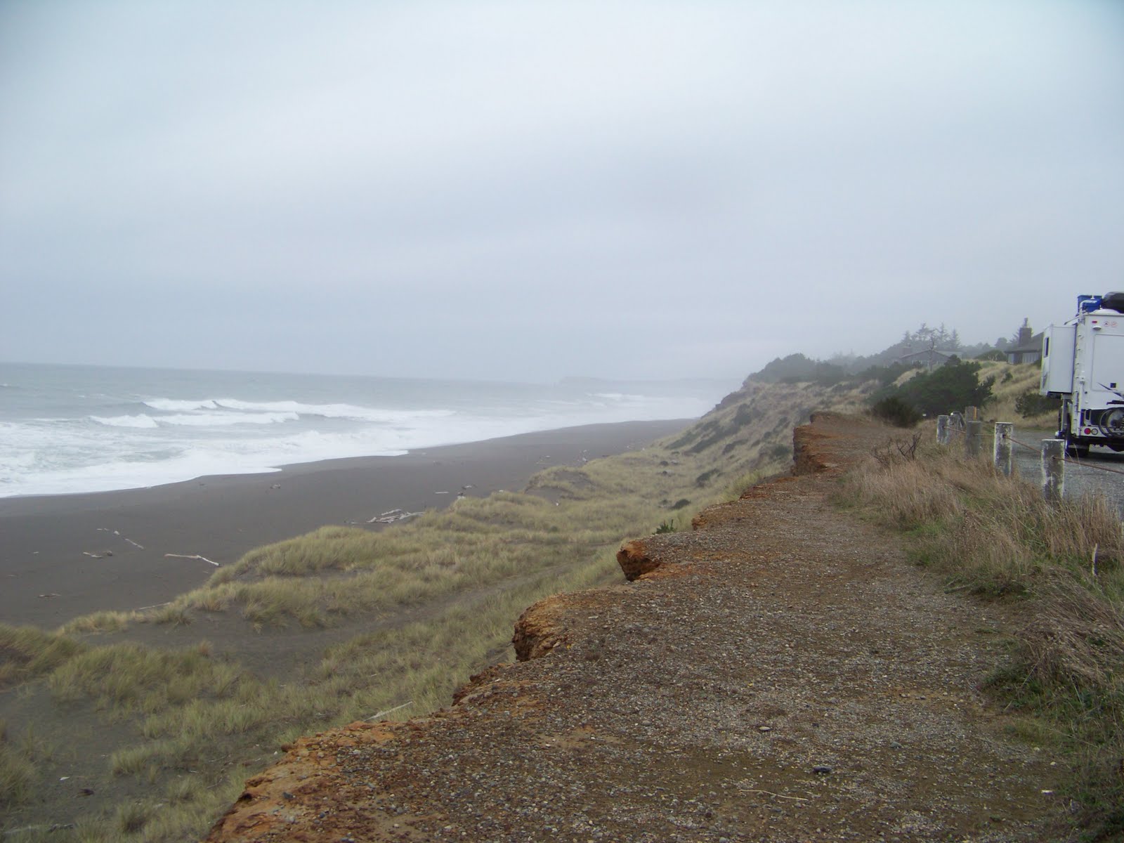
Thursday, October 21, 2010

Home to the sea lions


Nobody home today! So we went to the Moose Club #1210 in Florence, OR. Had a $5 chicken dinner and cheesecake with $2 pints of Coors light. They talked us into playing Bingo. Can't remember the last time we've played Bingo, had no idea it would take 3 1/2 hours! June Riley's would make this her second home. Sixteen women and us! They keep us entertained. Oh, gas was $2.68 and the cheapest in the state.

Heceta Head lighthouse


Located 205 feet above the ocean, the lighthouse is one of the most photographed on the coast. The light at top of 56-foot tower was illuminated in 1894; the automated beacon, seen 21 miles from land, is rated as the strongest light on the Oregon coast. The picture was taken from the sea lion caves.

Sea Lions playing


We went to the Sea Lion Caves near Florence, OR. It is nature's home for wild sea lions and a variety of sea birds. They were out playing in the ocean as none were in the caves as we made the our tour.

Coming Down is way more fun


Wheeeee!

We're up there!

Climbing the Dunes


Keith is getting ready to climb the dunes. 40 miles of dunes in Florence, OR. The clouds came in and the temp dropped.

Oregon Coast traveling to Florence, OR


Keith took this beautiful picture at this turnoff on highway 101.

Tuesday, October 19, 2010

Wildlife? Are you sure?


I was told there were gray whales at Depoe Bay. I was told we would see lots of seals at Seal Rock. I was told there is a herd of over 80 elk around the campground. But nothing, just nothing but these goats who had had enough of us!

In search of whales or seals


Stop at Seal Rock, OR looking for the gray whales and the local seals hanging out but found none.

Pacific Coast in Oregon


Mist created from the waves at Punch Bowl Bay. Looks like a nice golf shot to a green to me.

Our 13th new state in our travels so far...


The state line in the middle of the bridge.

Finished with nine....


Looking at our campsite at Randle, WA from the back of the ninth green next to the putting green.

Play Time!


Enough exploring the area, it's time to play. Nine hole course next to the RV. You're looking down the first fairway.

Thursday, October 14, 2010

Mt Rainier from Mt St Helens


One last look at Rainier from about 60 miles away as the crows fly.

Trip back


Just a nice view going back down the mountain.

Still smoking


Smoke can be seen coming from the mountain from our view point at Windy Ridge at 4170'.

Mount Saint Helens


There it is!

South end of Spirit Lake


At this end of the lake was where 85 year old Harry Randall Truman refused to leave his Mount St. Helens Lodge prior to the eruption. He had operated the lodge for 52 years. Truman is presumed to have died (along with 56 other people) in the eruption on May 18. A pyroclastic flow engulfed the Spirit Lake area, destroying the lake, and burying the site of his lodge under 150 feet of volcanic landslide debris. A new lake eventually formed on a much higher elevation.

Spirit Lake


Spirit Lake is now twice the size it was before the eruption and half full of floating logs.

More damage


Very large areas of blown down forest that once was.

May 18, 1980


Even after 30 years since the eruption, the forest has not recovered from the blast
from the volcano.

No hurry


Found this one lane bridge on the way to the mount. A little hairy if we had the RV!

Decisions, decisions, decisions...........


A beautiful thursday morning to go exploring Mt. St. Helens or is it. That golf course looks like it needs some action.

Wednesday, October 13, 2010

Moving a little further south to Randle, WA


Nice campground, beautiful day today. They have a small 9 hole golf course, so we golfed this afternoon. May stay a few days, but a front is supposed to be coming through so the weather will determine how long we stay in Washington. Will be visiting Mount St. Helens for sure.

Monday, October 11, 2010

6400' at the vistors center


There it is, the closest we can get by driving, to Mt. Rainer. By the way, it's 38 out up here and our Walden Oaks pullovers are just enough for pictures.

Snow?


GPS said 5744' when we saw the first signs of snowwwwwwwwww at 41 degrees.

Starting at the bottom


You're looking up at Mt. Rainier, 14410'.

Up the hill?


We went traveling on Monday to Mt. Rainer.

We [NYer's] though snow was bad


Like the info signs [speed limit 55 .... standing water] that Washington has on the interstate. Rain does slow them down here. By the way, speed limit is 75 on I90!

Moving on Sunday


Left Ellensburg Sunday for Black Diamond via I90 and passed thru this tunnel near Easton about 11AM. The following was reported on the news: "A small rockslide came down on a portion of westbound Interstate 90 about 13 miles west of Easton on Sunday afternoon. The State Patrol said the slide occurred at about 4 p.m. just east of the snow shed. The Department of Transportation said there was an eight-mile backup by 5:30 p.m.A huge boulder landed in the right lane with debris in the left lane.
Traffic was getting by in the left lane and on the left shoulder.
The right lane is closed until further notice." Missed that one!

Saturday, October 9, 2010

Made it safe and sound!

Petrified forest trail in the rain


Walked up and up and saw some more petrified wood. But the only thing that grows on this lava land is sage brush and, oh I forgot, rattlesnakes.

Petrified tree stump


Pretty cool, looks like wood, feels like stone.

Gingko Petrified Forest State Park


As we drove the 25 miles toward this park, I couldn't understand how you could have a petrified forest without any trees, but I found out. 15 million years ago lava poured over eastern Washington petrifying everything in it's path. Tree trunks have been dug up and displayed. Kind of amazing.